

How do I get there by bike?
I’ve been planning a number of summer trips recently, some that I plan to travel by bike and some by car, and it has made me realize just how different it is planning a trip by bike than by car.
The stark difference
When I plan to drive somewhere, I might look up directions the day before. Maybe. More often, I’ll plug the address into my phone right before I get in the car and have Google Maps talk me through the directions.
 But when I plan to bike to another city or destination in the mountains that I haven’t been to, it’s a whole different story. It is possible to get to most places in Colorado by bike, but many times “just Googling it” doesn’t work.
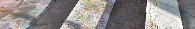
Planning usually involves some combination of Google Maps, printed bike maps, CDOT’s online Bicycle and Byways map, Strava, and—most importantly—talking to people who have biked the route before. The process serves as a great reminder of how important it is that we all keep pushing for roads and trails that accommodate people on bicycles.
A “secret” route
One of the routes I’ve been looking up recently is how to get from the Denver metro area up to Loveland Pass. I know I’m not the only one who is interested in this, so I thought I’d share my research.
An overview of the route:
- Denver to Golden: Clear Creek Trail
- Golden to Genesee Park: Lookout Mountain Road
- Genesee Park to the I-70 El Rancho exit: Interstate 70 Bike Path *updated 9/28/16*
- I-70 El Rancho exit to Kermitts Corner (I-70 exit 244): US-40 *updated 9/28/16*
- Kermitts Corner to the east side of Idaho Springs: Scott Lancaster Memorial Trail
- Through Idaho Springs: Colorado Boulevard
- Idaho Springs to Georgetown: Frontage roads
- Georgetown to Silver Plume: Silver Plume to Georgetown Express Trail
- Silver Plume to Bakerville: Frontage roads
- Bakerville to Loveland Pass Road: Bakerville to Loveland Trail
There are several tricky spots on this route. Getting from frontage roads to the Silver Plume to Georgetown Express Trail, for instance, involves biking through a parking lot. Bicycle Colorado is working for consistent signage for bicycle routes across the state, but we’re not there yet.
The future
Better options are planned to allow people to travel up to Loveland Pass by bike. A planned Peaks to Plains Trail would allow cyclists to travel this route exclusively on trail. Many of the sections of this Peaks to Plains Trail already exist, but there are missing links, including a 19-mile stretch through the Clear Creek Canyon. A six-mile portion in the middle of the canyon is under construction right now and is scheduled to open sometime this summer.

Leave A COMMENT
Keep Pace With Bicycle Colorado


Our twitter feed is unavailable right now.
The Latest News
view all- Jun 13, 2024
- by Bicycle Colorado
Discover Denver With Denver Century Ride
- Bicycling in Colorado,
- Denver,
- Event Member Spotlight,
- Events
- No Comments


COMMENTS (10)
Gary Kleeman -
Hi Katie–
FYI, You listed the leg from Genesee to Kermit’s as being I-40 and I-70. There is no I-40 in Colorado, it’s the old US Highway 40, aka the frontage road.
Katie Bonomo -
Thanks for pointing that out! I’ve updated the directions.
Martin Fulk -
Nice article Katie. Any suggestion for websites, etc., for finding out what smaller highways have shoulders / are rideable in other states? Huge question I realize…
It would be amazing if it were all in one website… bkeridingamerica.com. (Sorry that this isn’t a letter promoting such a website). I’ve had some luck just googling bike shops in towns nearby a chosen route and calling to see if any employee has riden said highway. (time consuming, though). Occasionally a state dept of tourism will have an answer or know a source.’
Love to hear other ideas.
Thanks.
Katie Bonomo -
Thanks, Martin! Unfortunately, I’m not aware of any complete sites for finding smaller highways to ride across the country. Some efforts have been started, like http://www.adventurecycling.org/routes-and-maps/us-bicycle-route-system/usbrs-interactive-map/, but I haven’t been able to find a resource that’s comprehensive. If anyone knows of such a resource, please post!
Bob Prehn -
Anyone can add information to the Open Street Map http://openstreetmap.org
I’ve added and edited hundreds of miles of paths/trails and cleaned up lots more.
You can add designated routes, shared vs segregated paths bike lanes etc.
You can view the open cycle map (highlights “cycleways”). The map can also be downloaded to Garmin GPS units.
Katie Bonomo -
Thanks for sharing that info, Bob!
Robert Clark -
Hi Bob,
I will be visiting Denver, Colorado in Late August. I plan on bringing my mountain bike out with me and I would like to bike a safe route from Commerce City, to Loveland Pass and back. I’m a little older now, 62, rather than when I used to bicycle up to Idaho Springs from Denver when I was 16 years old.
Brian Schroder -
Just looking for an update to this. Is there a new trail, better way now?
Katie Bonomo -
Hi, Brian. I checked with CDOT about the construction schedule for the Genesee – El Rancho Trail, and the completion date has been pushed back a bit to late July or early August, so these directions are still current as of today. Happy riding!
Rick -
Hey There,
This has been extremely helpful!!! thank you for creating it.
Not sure if you still check this years later now, but I am going from Denver to Moab in May Via cycling. It seems all of these bikes trails have specific names and don’t like to pop up in a google search. if anyone is aware of trails on the west side of the divide following out to Grand Junction and eventually Moab, if you could drop the names here, I’ll take it from there. Thanks so much!!!